New South Wales & Act
-
Bathurst Dubbo Orange & Surrounds UBD 282
A double sided map of the overall area and with town maps and street indexes of…
$12.00
-
Byron Bay Wollumbin Mt Warning Ballina Hayman's
NSW Far North Coast - Includes: Lennox Head, Murwillumbah, Nimbin, Lismore, Brunswick Heads…
$12.00
-
Canberra Suburban Streets UBD 259
This map is reverse side printed and extends from Hall in the north to Banks in the…
$12.00
-

Central Coast Suburban Streets UBD 289
This map is double sided. Both sides includes a 1:25,000 scale map of the Central Coast of New South…
$12.00
-
Central West Forest
An outdoor adventure map that covers the Blue Mountains including the Central Tablelands, the…
$12.00
-
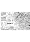
Map of Kowmung
Myles Dunphy's topographic map covers a section of the Southern Blue Mountains of N.S.W.. It is a…
$12.00
-
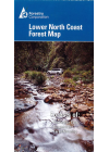
Lower North Coast New South Wales Forest
This map covers the area from Hawks Nest to Crowdy Bay in the east and from Branxton to Glenrock in…
$12.00
-
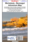
Merimbula-Bermagui Rooftop
Includes: Bombala, Cathcart, Wyndham, Merimbula, Tathra, Bermagui, Bega, Bemboka, Cobargo, Tilba…
$12.00
-
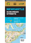
Newcastle Suburban Streets UBD 280
One side features a regional touring map which covers the Hunter Valley and surrounding region…
$12.00
-
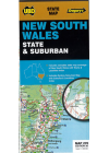
New South Wales State & Suburban UBD 270
The map has the whole state on one side at 1:1 600 000, showing major roads and tracks and…
$12.00
-
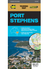
Port Stephens UBD 295
This map of Port Stephens to Myall Lakes NP, Greswick and Glen Oak to the north, west to Millers…
$12.00
-
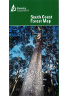
South Coast Forests New South Wales Map
This map covers the coastal region around those towns including Jervis Bay plus the state forests…
$12.00
-
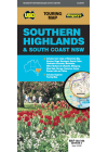
Southern Highlands & South Coast of New South Wales UBD 283/298
Regional touring map covering the coast from Shellharbour in the north to Eden in the south and west…
$12.00
-
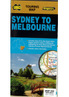
Sydney to Melbourne UBD 245
Sydney and Melbourne highlighting the Hume & Princes Highways and also includes tourist…
$12.00
-
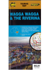
Wagga Wagga & The Riverina UBD 284
This map extends to the north Rankins Springs, Grenfell and Cowra, to the east Wyangala and…
$12.00
-
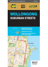
Wollongong UBD 299
This map covers Wollongong and it's surrounding suburbs and includes maps of Nowra and Berry and…
$12.00
-

Gangerang Wild Dog Mountains
Myles Dunphy's topographic map covers the Greater Blue Mountains of N.S.W.. It is a hand drawn map…
$12.00
-
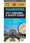
Canberra City Suburbs & South Coast UBD 248
Touring map which includes strip maps for travelling both the Princes Highway/Freeway & the Hume…
$11.00
-
New South Wales State Hema Handy
A fully indexed state map of New South Wales printed on two sides - the eastern half of NSW on one…
$10.00
-
Southern Highlands Craigies
The Southern Highlands map extends from Picton in the north to Nowra in the south & west to…
$10.00