Enlarge


Aquitaine #524 Michelin
$25.00
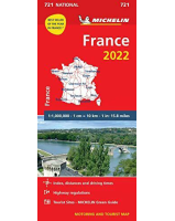
This map of Aquitaine Region in France @ 1:200,000 by Michelin is a double-sided touring map designed to present a larger area by covering administrative regions of the country. This series provides an alternative to the publisher’s Local Series of 45 maps at 1:150,000 with division based on the departments.
Maps in the REGIONAL series are indexed and include street plans of main towns, a regional distance table, plus a panel with main driving regulations in France. The road network is in great detail, indicating width and the number of lanes, motorway services and rest areas, dangerous or restricted entry roads, steep gradients, height and weight restrictions, etc. Scenic sections are highlighted. The map also show selected cycle paths and nature trails. Railway lines are shown with stations and local airports are marked. Satellite-derived base with colouring for the forested areas and boundaries of national or regional parks shows the topography. In the mountainous regions the maps have bold, very effective relief shading, with a large number of names of peaks, passes and other topographic features. The map legend includes English.