 Enlarge
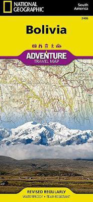
Bolivia National Geographic
$20.00
This NGS map of Bolivia helps you to find your destination with the aid of a user-friendly index of cities, towns and protected areas. Then, it allows you to plan your route using the mapped road network, complete with distances and designations for major and secondary roads as well as tracks and trails for those seeking to travel off the beaten path. Other travel network features include airports, airfields, railroads, ferry routes and border crossings. In addition, hundreds of cultural, historical, ecological and recreational points of interest are pinpointed, such as camping areas, archeological sites, geysers, spas, churches and UNESCO World Heritage Sites.
The map's north side covers the country from its northern borders with Brazil and Peru down to the capital of La Paz, including Madidi and Noel Kempff Mercado National Parks, Tiwanaku and Lake Titicaca. While the south side covers the more mountainous southern half of the country from La Paz to the borders with Paraguay, Chile and Argentina. Included are the cities of Potosi and Sucre, Eduardo Avaroa Andean Fauna National Reserve and the world's largest salt flat, Salar de Uyuni.
Printed on durable synthetic paper, making it waterproof, tear-resistant and tough — capable of withstanding the rigors of international travel.