 Enlarge
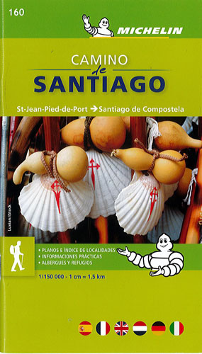
Camino de Santiago Michelin Pocket Atlas 160
$30.00
This handy pocket atlas by Michelin covers from St-Jean-Pied-de-Port to Santiago de Compostela which is the main route of the Way of St. James across northern Spain. It starts in St-Jean-Pied-de-Port on the French side of the Pyrenees and follows 'the way' to Santiago de Compostela in north west Spain.
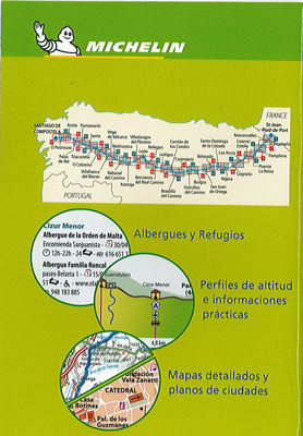
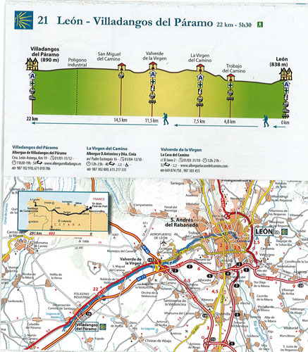
Each page of this atlas covers between 20-30 kilometres of the route, one page with a map with the route highlighted on it, the other page shows a route profile with accomodation and other services. Opening times, number of beds and contact details are given for the hotels along the way as well as the distance from the start point on the map.
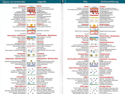
The maps show road detail from motorways to rough tracks and footpaths, with intermediate road distances shown on most roads, toll and toll-free sections of motorways are indicated and various road obstacles such as steep hills, one way streets and prohibited roads are marked.
Relief shading and spot heights indicate topography. View points, scenic routes, religious and historic buildings, caves, palaces and villas, parks and places of touristic interest are marked with symbols. An index is included and the legend has an English translation as well as other languages.
A number of street maps are included covering the major cities and towns along the way, Pamplona, Logrono, Burgos, Leon and Santiago de Compostela with road names and points of interest.