 Enlarge
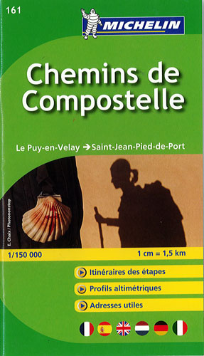
Chemins de Compostelle Michelin 161
$25.00
This Michelin handy pocket Atlas for the Chemins de Compostelle is ideal to fully explore this world famous pilgrimage. It is in an easy-to-use booklet format with a scale @ 1:150,000.
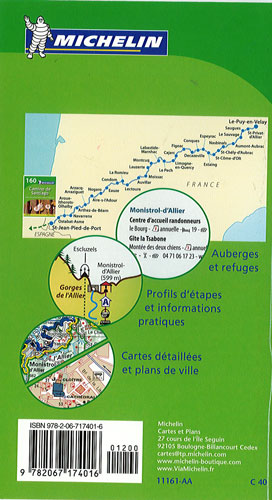
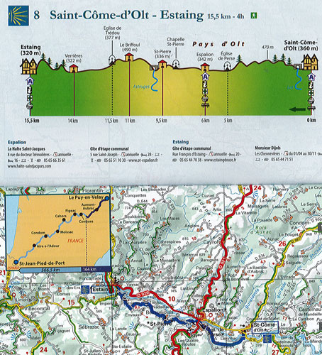
It covers the route from Le Puy en Velay to Saint Jean Pied de Port and is an indispensable tool for all walkers on the way to Saint Jacques - more than 730 km of the course. It is cut into stages with one page a map and associated information highlighted that will be useful on your way: hostels, refuges, pharmacies, grocery stores, km remaining, km travelled. For a given step, consult the altimetry profile of your journey along the map. Included are Town maps for Figeac, Cahors, Moissac, Condom, Saint-Jean-Pied-de-Port and Puy-en-Velay.