 Enlarge
Cocos (Keeling) Island 1:25,000
$15.00
Cocos (Keeling) Islands became an Australian Territory in 1955. An Administrator appointed by the Govenor-General is the most senior Australian Government representative and is responsible for the law, order and good governance of the Territory.
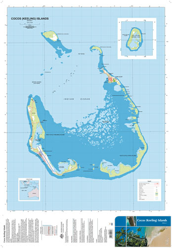
These islands are located in the Indian Ocean approximately 2,950km north-west of Perth, 3,700km west of Darwin & 900km south-west off Christmas Island. There are 27 coral islands in the gorup with a total land area of approx. 14sq kms.
In 2006 the population numbered 621 people with approx 80% residing on Home Island. North Keeling Island is found 24km to the north and is a single horseshoe shaped atoll about 1.2sq km. There are 26 islands in the southern atoll of which 2, Home Island & West Island are inahabited. Both atolls are the typical horseshoe shape formation and are affected by the prevailing winds and oceans. Coral sand beaches are to the seaward and mudflats can be found on the lagoon side.
Cocos (Keeling) islands is home to some unique endemic species of wildlife. The northern atoll of North Keeling Island and the marine area extending 1.5km around the Island from the Pulu Keeling National Park. This supports an internationally significant seabird rookery, is home to land crabs, turtles, a range of flora and features an intact coral atoll.
The climate is tropical with high humidity. Temperatures range from 23deg C to 30deg C and the average rainfall is 2,000mm per annum, falling mainly from January to August. The south-east trade winds blow most of the year producing pleasant weather conditions.
Printed In-House on waterproof paper