 Enlarge
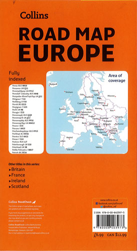
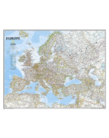
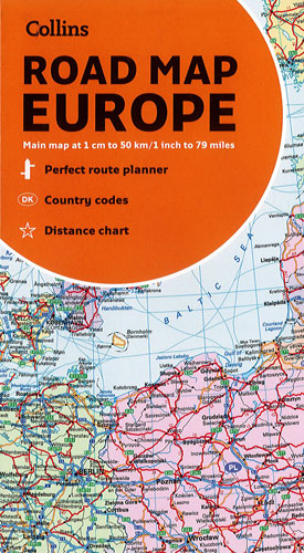
Europe Collins Road Map
$15.00
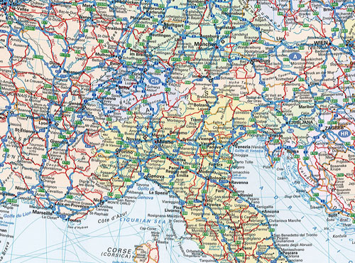
Political road map of Europe 1":79 miles / 1cm:50km showing the country boundaries, roads, motorways, European Route numbers, railways, airports, cities and towns are clearly shown. Area of coverage is from the North Cape (Norway) to Gibraltar and from Ireland to east of Moscow. Also includes Iceland and Cyprus.
Included full index to place names (on reverse of sheet), distance chart giving distances in kilometres between main towns, European Union map showing member states and the Eurozone, key to approved country code abbreviations – GB, F, D etc, legend in English, French, German, Spanish and Italian