 Enlarge
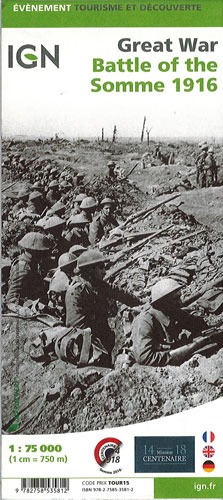
Great War - Battle of the Somme 1916 IGN
$28.00
Commemorative map published by the IGN for the anniversary of the Battle of the Somme showing the front lines from 1st July to 30th November 1916 and presenting very clearly access to present day remains, monuments and numerous war cemeteries. The map was prepared by IGN in collaboration with La Maison du centenaire de la Première Guerre mondiale, the Commonwealth War Graves Commission and Sommetourisme.
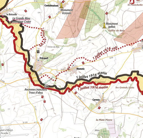
The main map at 1:75,000 extends from north of Arras and Vimy to Amiens, Péronne and the French Army positions south of the Somme, indicating the Front line on 1st July 1916, plus on 17th, July, 13th September and 30th November. Within the area covered by the British Third Army and the French Seventh Army dispositions of individual Corps and Divisions are shown, with similar information but in less detail provided for the German forces. Symbols indicate locations of remains of the military fortifications, war memorials, cemeteries, etc.
A large panel at 1:35,000 shows in greater detail main area of the Battle of the Somme between Albert and Bapaume, along the front line from Hébuterne in the north, across Beaumont-Hamel and Thiepval, to the Somme. Additional overprint includes a “Circuit du souvenirs” route. The main map and the enlargement use as their base cartography of IGN TOP100 series with contour lines at 10m intervals and colouring for woodlands.
The map also includes a reproduction of an original trench map for the Dompierre-Becquincourt area, a chronology of the Battle of the Somme, plus notes on the organizations which collaborated with IGN in preparing the map. Map legend and all the text are in English, French and German