 Enlarge
Kakadu National Park GeoSciences
$15.00
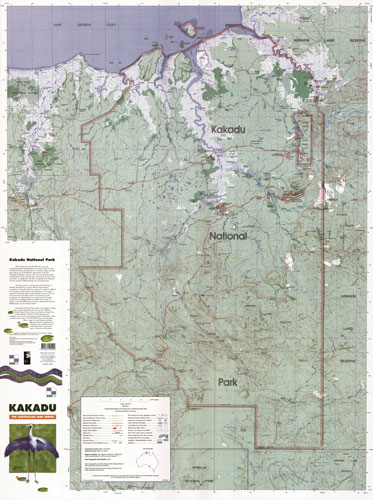
This large topographic map features the full 20 000 square kilometres of the Kakadu National Park as well as the surrounding area. At a scale of 1:250 000, the map includes contours at 50m intervals, highlighted information centres and park ranger stations, walking tracks, lookouts, vegetation density and the access, surface and 4WD status of roads and tracks.
Printed In-House on waterproof paper