 Enlarge
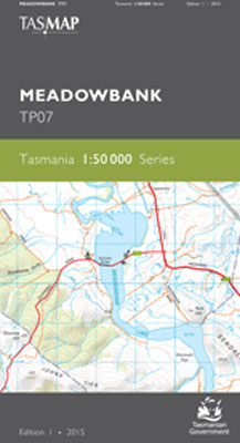
Meadowbank TP07 1:50,000 Tasmap
$15.00
This map covers the rural lower Derwent Valley between Ouse and Bushy Park and includes the historic township of Hamilton. Meadowbank Lake is the central feature and is a popular recreational venue for water skiing and fishing. Mount Field National Park in the south west of the map is noted for its glacial landscape and numerous bush walks.
It provides a clear and accurate portrayal of topographic information, with symbols and map content giving enhanced depiction of buildings, hill shading and a simplified classification of vegetation.