Montana & Wyoming Rand McNally
$16.00
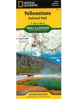
This Rand McNally map of Montana & Wyoming depicts all Interstate, U.S. state and county highways along with streets, parks, aiports and county boundaries. Its detailed index, legend and mileage chart and driving times map will help users to reach their destination with ease. Also included are maps of Billings, Butte, Casper, Cheyenne, Cody, Great Falls, Helena, Laramie and Missoula. In addition, Grand Teton National Park, Waterton Glacier International Peace Park and Yellowstone National Park are depicted in detail.


