 Enlarge
South Pacific Cruising & Samoa ITMB
$20.00
This map of the South Pacific Ocean extends southwards from Hawai'i to the southern tip of New Zealand and eastwards from Central Australia/Papua New Guinea to the Pitcairn Islands. At 1:12M, most of the area covered is water, with island countries such as Fiji, Tonga, Kiribati, Tahiti, and the Cook Islands being visible, but without details.
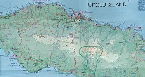
The map of the South Pacific region fills one side of the map. The cruise routes at the moment are shown with red dashed lines. The ocean area includes hill shading for the deep trenches of the Pacific Ocean. The reverse side is Samoa in the centre of the South Pacific and several cruise companies stop at Pago Pago. The two Somoas with two main islands and two small islands are @ 1:160,000 scale. An inset map of the capital, Apia is included. American Samoa consists of half a dozen islands that are rather far apart from each other. The main urban area is Fagatogo in Pago Pago harbour on the only island with an airport, Tutuila.