Enlarge


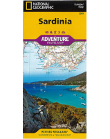
Corsica National Geographic Adventure
$30.00
In NGS' map of Corsica cities and towns are clearly indicated and easy to find in the user-friendly index. A road network complete with distances and designations for major roads, expressways, scenic routes and secondary roads will help you find the route that's right for you. Beaches, winter sports resorts, golf courses, spas, castles, churches, camping areas and UNESCO World Heritage sites are clearly indicated. The locations of airports, airfields, harbors, marinas and ferry routes take the guesswork out of travel around the island.
One side of the print map details the northern region of this island country; bordering Golfe de Sagone and Golfe de Porto to the west, Tyrrhenian Sea to the east and the Ligurian Sea and Golfe de St.-Florent to the north. The reverse side of the map shows the southern region; from its border with the Bouches de Bonifacio to the south, to the Tyrrhenian Sea, Golfe de Santa-Manza and Golfe de Porto-Vecchio to the east and the Mediterranean Sea, Golfe de Sagone, Golfe de Valinco and Golfe d' Ajaccio to the west.
Printed on durable synthetic paper, making it waterproof, tear-resistant and tough — capable of withstanding the rigors of international travel.