Enlarge
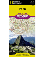
Ecuador & Galapagos Islands National Geographic Adventure
$30.00
NGS' Ecuador and Galapagos Islands Adventure Map, with its comprehensive information, is uniquely designed for adventure travelers. The map delivers unparalleled detail of the entire country and its recreational, historical, cultural and natural destinations. Pinpointed spots include beaches, wildlife areas, archeological sites, churches and areas for camping, surfing, fishing and diving. A list of cities and towns with a user-friendly index is provided along with a road network of highways, major and secondary roads, shown with distances. Unsurfaced and 4-wheel-drive roads are mapped for those wishing to get off the beaten track. Other displayed travel aids include airports, airfields, harbors, anchorage sites, railroads, ferry routes and border crossings with neighboring Colombia and Peru.
The northern part of the map covers the capital city of Quito, Cotopaxi Volcano and National Park, Cuyabeno Wildlife Reserve while the southern part of the map covers from Guayaquil to the southern and southeastern border with Peru. An inset map covers the world renowned Galapagos Islands, showing Galapagos National Park and Marine Reserve, Tortoise Reserve and diving areas around the islands.
Printed on durable synthetic paper, making it waterproof, tear-resistant and tough — capable of withstanding the rigors of international travel.