 Enlarge
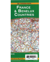
Netherlands Belgium Luxembourg Itmb
$20.00
This is a double sided map with Netherlands & Belgium on one side. The Belgium portion shared with Luxembourg is on the other side.
Motorways are in blue, main roads in green, and other roads in red casting. Road distances between points are noted, as well as motorway rest areas and touristic sites such as windmills, noteworthy churches and camping areas. Height elevations are minimal but park areas have been shown. The border portion of France is also included, as well as appropriate border portions of Germany. The 'Low Countries' are very interesting for visitors and include canals, historic cities such as Bruges, Leuven, and Liege and the battlefield region of Bastogne and 'The Bulge'. This map is also includes the West Frisian Islands and adjacent Germany and France with complete index of all cities and towns.