Victoria
-
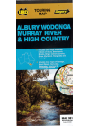
Albury Wodonga Murray River High Country Ubd 381
This map extends north to Finley, Culcain & Holbrook in NSW, east to Bullioh, Mitta Mitta…
$12.00
-
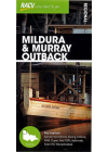
Mildura and Murray Outback RACV
RACV's regional map of Mildura and Murray Outback provides maps of the region and the town centres…
$10.00
-
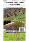
Bairnsdale - Dargo - Omeo Adventure Rooftop
This map is from the Gippsland Lakes into The High Country and covers from Paynesville, Metung and…
$15.00
-
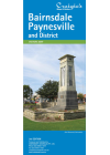
Bairnsdale Paynesville & District Craigies
The map extends from Bruthen in the North to Loch Sport in the South, Nowa Nowa in the East and…
$8.00
-

Beechworth - Albury - Wangaratta Adventure Rooftop
Murray Valley and North East Victoria. This map covers from Rutherglen to Hume Weir and…
$13.00
-
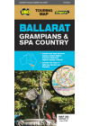
Ballarat Grampians & Spa Country UBD 382
A regional touring map covering Harcourt & Campbells Bridge in the north, Cressy in the
south…$11.00
-
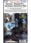
Barmah - Shepparton - Deniliquin Adventure Hayman's
This map includes the River gum National Park. The map coverage at 1:100,000 scale is from…
$13.00
-
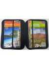
Map Wallet
Suits A4 & B4 size atlases and all maps
$25.00
-
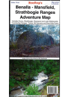
Benalla Mansfield Strathbogie Ranges Adventure Rooftop
Including Strathbogie, Toombullup, Lake Nillahcootie, Mount Samaria, Mount Wombat, Reef Hills, Mount…
$14.00
-
Bendigo Shepparton UBD 383
This double sided map is a regional touring map of this part of Victoria with the map…
$12.00
-
Big River - Rubicon - Sheepyard Flat Forest Activities Rooftop
This map is double-sided providing the user with even more value for money. One side includes Big…
$15.00
-
Bogong Alpine Area 1:50k Spatial Vision
The Bogong Alpine Area recreation guide provides information and detailed maps for walking and…
$35.00
-
Bright - Dartmouth Adventure Rooftop
Omeo to Bright, Mitta Mitta, Lake Dartmouth. Bush Huts Bright, Omeo, Dartmouth & Bright Bogong…
$15.00
-
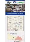
Eildon Special 50k Vicmap
This map includes the whole of Lake Eildon plus Mansfield, Jamieson, Eildon, Goughs Bay, Howqua…
$14.00
-
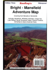
Bright - Mansfield Adventure Rooftop
This map covers from Myrtleford, Bright, Moyhu and Benalla in the north to Mansfield, Whitfield…
$15.00
-
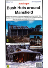
Bush Huts Around Mansfield Rooftop
Each hut is described with a brief background history and a colour photograph. The detailed…
$8.00
-
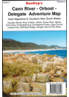
Cann River - Orbost - Delegate Adventure Rooftop
This map extends from Orbost and McKillops Bridge to Cann Valley Highway and Tamboon Inlet. An…
$16.00
-
Cohuna - Echuca - Gunbower Forest Activities Hayman's
Including the Murray River Red Gum Forestsl Perricoota, Koondrook, Campbell's Island, Guttrum…
$11.00
-
Mallacoota 8822-N 1:50,000 Vicmap
Croajingolong National Park east of Mallacoota. Entire Mallacoota Inlet, Cape Howe Wilderness, Gipsy…
$14.00
-
Corryong - Omeo - Thredbo Adventure Rooftop
This map includes Corryong, Khancoban, Nariel, Gibbo, Pinninbar, Tom Groggin, Benambra, Omeo…
$16.00
-
South East Australia Meridian
1:1,250,000 scale wall map of South East Australia covering the most populous corner of Australia…
$15.00
-
Dandenong Ranges & Lysterfield Hills Meridian
The Dandenong Ranges are one of Melbourne’s favourite playgrounds and walks in the parks some…
$11.00
-

Dargo - Wonnangatta Adventure Rooftop
Map coverage is from Licola to Mount Hotham and from Briagolong to the Buckland Valley and…
$15.00
-
Dartmouth - Cobberas 4WD Spatial Vision #5
Covering Omeo, Mt Anderson Peak, Thredbo, Mt Benambra, and Lake Dartmouth, the map has a unique…
$12.00
-
Gippsland Discovery Wilsons Promontory UBD 386
This Gippsland Discovery & Wilsons Promontory touring map extends from the eastern suburbs of…
$12.00
-
Geelong Suburban UBD 385
This map of Geelong by Ubd is a double sided map that includes the Geelong city @ 1:12,500. On one…
$12.00
-
The Peninsula Special 1:50,000 Vicmap
Map coverage includes the whole of the Bellarine Peninsula on one side and Mornington Peninsula…
$14.00
-
Gippsland Lakes Ninety Mile Beach Adventure
Coverage of the coastline extends from McLoughlins Beach to Lakes Entrance inland to Heyfield…
$16.00
-
Grampians National Park Parks Victoria
This map is ideal for 4WDing & touring the Grampians National Park. The map highlights all of…
$6.00
-
Great Ocean Road Ubd 308
This map gives detailed coverage of Anglesea, Apollo Bay, Camperdown, Colac, Geelong City Centre…
$12.00
-
Wilsons Promontory Special 1:50k Vicmap
Map coverage includes the whole of Wilsons Promontory National Park plus Yanakie and Duck Point at…
$14.00
-
Great Ocean Walk - Parks Victoria
Information guide and official map for The Great Ocean Walk from Apollo Bay to The Twelve Apostles…
$16.00
-
Great South West Walk & Lower Glenelg Cartographics
Great South West Walk & Lower Glenelg Map - Carto Graphics. Detailed topographic standard…
$15.00
-
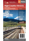
High Country Victoria Hema
A waterproof and tearproof map covering High Country Victoria at a touring scale of 1:200,000. The…
$15.00
-
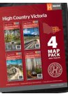
High Country Victoria Hema 4 Map Pack
The Victorian High Country series in a soft and durable map wallet which includes four detailed…
$55.00
-
High Country Victoria - North East Hema
This map is part of Hema's new Victorian High Country Map Series and covers the Northern Borderlands…
$15.00
-
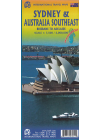
Australia Southeast & Sydney ITMB
This map of Southeast Australia & Sydney by ITMB is double sided. One side @ 1:2,000,000…
$18.00
-
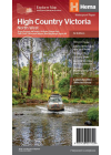
High Country Victoria - North West Hema
This map is part of Hema's new Victorian High Country Map Series and covers the North Western Alps…
$15.00
-
High Country Victoria - South East Hema
This map is part of Hema's new Victorian High Country Map Series and covers the Southern…
$15.00
-
High Country Victoria South West Hema
This map is part of Hema's new Victorian High Country Map Series and covers…
$15.00
-
Jamieson - Licola Adventure Rooftop
This map covers from Goughs Bay, Jamieson and the Howqua River in the north to the Upper Thomson…
$13.00
-
Lake Eildon Boating Rooftop
This a special map focusing on all the relics, ruins and sites submerged when the lake is full and…
$9.00
-
Lakes Entrance & District Craigies
The Lakes Entrance & District Map extends from Bruthen in the North to Loch Sport in the South…
$7.00
-
Lerderderg & Werribee Gorges Meridian
1:30,000 scale topographic map of the Lerderderg State Park and 1:20,000 map of Werribee Gorge State…
$11.00
-
Mansfield - Mt. Howitt Adventure Rooftop
Map coverage is from Mansfield and Lake Cobbler in the north to Jamieson, Kevington and Mount Sunday…
$9.00
-
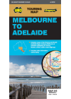
Melbourne to Adelaide Hema
A city to city map from Melbourne to Adelaide (1:900,000) that features the Great Ocean Road…
$15.00
-
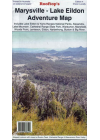
Marysville - Lake Eildon Adventure Rooftop
Map coverage is from Mansfield, Bonnie Doon and Merton in the north to Warburton Upper Yarra…
$15.00
-
Melbourne to Adelaide Ubd 345
Includes maps of the Victoria and South Australia region between Melbourne & Adelaide…
$12.00
-
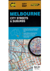
Melbourne City Streets & Suburbs UBD 362
This map shows detailed coverage of Melbourne and it's surrounding suburbs and includes…
$14.00
-
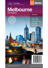
Melbourne & Region Hema
A city and suburbs road map of Melbourne that has additional information and maps for discovering…
$10.00
-
Mornington Peninsula Walks Meridian
Double-sided multi-scaled map of Mornington Peninsula National Park and Arthurs Seat State Park…
$11.00
-
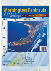
Mornington Peninsula Meridian
Includes Western Phillip Island and North Arm of Western Port, Postcode numbers and boundaries…
$20.00
-
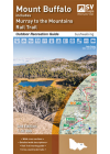
Mount Buffalo 1:30k Spatial Vision
This guide is a must for everyone that loves the Mt Buffalo National Park. The Buffalo recreation…
$14.00
-
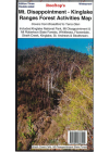
Mt Disappointment - Kinglake Ranges Forest Activities Rooftop
This map includes Reedy Creek, Wandong, Upper Plenty, Mount Disappointment, Hazeldene…
$12.00
-
Mt Feathertop & Mt Bogong Rooftop
This map of Mt Feathertop & Mt Bogong by Rooftop is a double side print on waterproof paper…
$15.00
-
Northern Grampians Outdoor Recreation Spatial Vision
This Northern Grampians guide is the ideal companion when exploring this great part of Victoria as…
$25.00
-
Otways 4WD Spatial Vision #4
This map is specifically formulated for 4 wheel drivers as it includes the latest topographic…
$12.00
-
Mallacoota - Merimbula Adventure Rooftop
Includes: Bombala, Eden, Merimbula, Cann River, Wolumla, Wyndham, Wonboyn Lake, Ben Boyd NP…
$17.00
-
Otways Central Walks & Waterfalls Spatial Vision
This outdoor recreation guide covers the Central Otway region at 1:50,000 scale and is ideal for…
$16.00
-
Otways East Surf Coast Spatial Vision
This outdoor recreation guide map to Eastern Otway region (Torquay to Lorne) is deal for bushwalking…
$16.00
-
Otways West Shipwreck Coast Spatial Vision
Spatial Vision's Otways West -Shipwreck Coast map includes Port Campbell National Park plus a…
$16.00
-
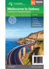
Melbourne to Sydney Hema
This map takes you from Melbourne to Sydney via the Princes and Hume Highways and everything in…
$15.00
-
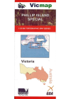
Phillip Island Special 25k Vicmap
This is a clip from the Victorian Index to show the area of coverage for the 7920-4N & 7920-1N…
$13.00
-
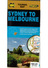
Sydney to Melbourne UBD 245
Sydney and Melbourne highlighting the Hume & Princes Highways and also includes tourist…
$12.00
-
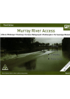
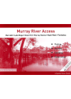
Murray River Access Book No. 3
Albury - Wodonga - Howlong - Corowa - Wahgunyah - Rutherglen - Yarrawonga - Mulwala. This book…
$10.00
-
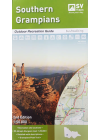
Southern Grampians Outdoor Recreation Spatial Vision
This Southern Grampians guide is the ideal companion when exploring this great part of Victoria as…
$25.00
-
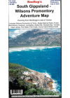
South Gippsland - Wilsons Promontory Adventure Rooftop
Map coverage includes Wilsons Promontory & Tarra - Bulga National Parks, Foster, Korumburra…
$12.00
-
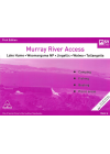
Murray River Access Book No. 5
Murrabit - Lake Boga - Swan Hill - Murray Downs - Nyah West - Tooleybuc. This book includes good…
$10.00
-
Murray River Access Book No. 6
Lake Hume - Woomargama NP - Jingellic - Walwa - Tallangatta. This book includes good mapping (GPS…
$10.00
-
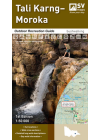
Tali Karng - Moroka 1:50k Spatial Vision
This guide contains a detailed map of the region at 1:50,000 scale, covering the key locations of…
$14.00
-
Murray River Access Book No. 7
Tooleybuc - Boundary Bend - Robinvale - Euston - Wemen. This book includes good mapping (GPS…
$10.00
-
Tallarook Forest Activities Rooftop
Coverage includes Tallarook State Forest, Mount Hickey, Warragul Rocks, Falls Creek Reservoir…
$6.00
-
Murray River Access Book No. 8
Wemen - Colignan - Kings Billabong - Gol Gol - Buronga - Mildura. This book includes good mapping…
$10.00
-
The Otways 4WD Meridian
1:100,000 scale map covering the entire Otway Ranges from Anglesea to Princetown. Detailed roads and…
$15.00
-
Murray River Access Book No. 9
Mildura - Wentworth - Neds Corner. This book includes good mapping (GPS compatible) and information…
$10.00
-
The Pyrenees (Victoria) Meridian
For the first time the entire Pyrenees region is available on a single double-sided 1:50,000 scale…
$15.00
-
Murray River Access Book No. 10
Neds Corner - Lindsay Island - Chowilla - Renmark - Paringa. This book includes good mapping (GPS…
$10.00
-
Murray River Access Book No. 11
Ulupna Island - Barmah - Edward River - Mathoura - Deniliquin. This book includes good mapping (GPS…
$10.00
-
Toolangi - Black Range Forest Activities Rooftop
Coverage includes Toolangi, Murrindindi, Buxton, Narbethong, Wilhelmina Falls, Stanleys Homestead…
$12.00
-
Toolangi - Macedon Adventure Rooftop
Map coverage is from Alexandra, Narbethong and Buxton in the east to Cobaw, Lancefield, Macedon and…
$13.00
-
Murray River Access Book No. 12
Jingellic - Walwa - Tintaldra - Corryong - Khancoban - Murray Source. This book includes good mapping…
$10.00
-
Upper Murray Adventure Rooftop
Coverage extends from Albury / Wodonga to Corryong and from the Murray River, south to Mitta Mitta…
$6.00
-
Victoria's Deserts 4WD Meridian
1:350,000 scale map covering the all the Mallee parks of Victoria from the Little Desert through to…
$15.00
-
Victoria State & Cities Ubd 319
Map of the State of Victoria on one side with the major city centres on the reverse. Waterproof &…
$14.00
-
Victoria State Hema
A state map of Victoria including touring information and relevant regional and city maps. Also…
$15.00
-
Murray River Access Book No. 1
Yarrawonga - Mulwaa - Cobram - Barooga - Tocumwal - Ulpena Island. This book includes good mapping…
$10.00
-
Victoria State Hema Handy
The eastern half of Victoria is on one side of this map and the reverse side has the western…
$10.00
-
Murray River Access Book No. 2
Barmah - Echuca - Moama - Torrumbarry Weir. This book includes good mapping (GPS compatible) and…
$10.00
-
Murray River Access Book No. 4
Gunbower Island - Cohuna - Barham - Koondrook - Murrabit. This book includes good mapping (GPS…
$10.00
-
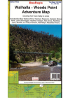
Walhalla - Woods Point Adventure Rooftop
This map includes Baw Baw National Park, Thomson Reservoir, Heyfield, Mirboo North, Lake Glenmaggie…
$13.00
-
New South Wales, Victoria & Tasmania ITMB
This map bi ITMB @ 1:900,000 is a double sided map of South East Australia covering all of NSW…
$20.00
-
Wombat State Forest 4WD Meridian
Double-sided 1:50,000 scale map covering the entire Wombat State Forest from Daylesford through to…
$15.00
-
Yarra Valley - West Gippsland Adventure Rooftop
Map coverage is from Marysville, Narbethong and Cumberland Junction in the north to Mount Worth…
$13.00
-
Wilsons Promontory 1:50k Spatial Vision
An outdoor recreation and bushwalking guide to Wilson's Promontory at an appropriate scale of…
$20.00
-
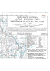
Alpine National Park Wabonga Plateau Section Victoria S.R. Brookes
#4 1998
$8.00
-
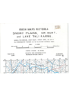
Snowy Plains, Mt Kent & Lake Tali Karng Victoria S.R Brookes
#16 2001
$12.00
-
 Sale
Sale
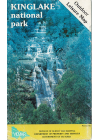
Kinglake National Park Vicmap
This Kinglake National Park Outdoor Leisure map @ 1:25,000 has the topographical detail of the…$10.00$8.00
Showing 1 — 97 of 97