Great Britain & Ireland
Shop by Category
-
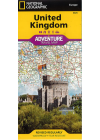
United Kingdom National Geographic Adventure
The NGS United Kingdom Adventure Map is detailed, accurate and user-friendly. One side covers…
$25.00
-
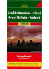
Great Britain & Ireland Freytag & Berndt
Explore Great Britain & Ireland with this Freytag&Berndt double-sided road map. The best way…
$25.00
-
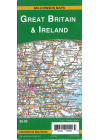
Great Britain Ireland GMJ
This map of Great Britain & Ireland is double sided with Freytag & Berndt mapping and…
$17.00
-
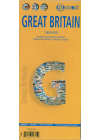
Great Britain Borch
Folded road and travel map in color. Scale 1:800,000 showing motorways to secondary roads. Legend…
$25.00
-
Great Britain ITMB
This map of Great Britain combines a detailed road map with a touristic sites map @ 1:720,000…
$20.00
-
England Wales Freytag & Berndt
This map of England Wales by Freytag & Berndt @ 1:400,000 is double sided with the Western half…
$25.00
-
England North & Central Railway & Road ITMB
This ITMB map of England North & Central Railway & Road covers from…
$20.00
-
England South East & Midlands Railway & Road ITMB
South East England - from the English Channel north to the northern tip of East Anglia and west to…
$20.00
-
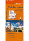
South East England - Midlands, East Anglia #504 Michelin
South East England, The Midlands and East Anglia #504 is an indexed touring map @ 1:400,000 by…
$25.00
-
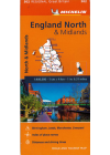
England North & Midlands #502 Michelin
Thi North Englanc & Midlands regional touring map @ 1:400,000 by Michelin contains the practical…
$25.00
-
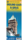
England South & Wales Itmb
This England South (or Southern England) including Wales is great for those who fly into one of…
$20.00
-
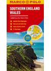
Southern England Wales Marco Polo
This Marco Polo map of Southern England and Wales @ 1:300,000 will help you discover a region of…
$20.00
-
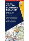
Central Southern England AA 2
This AA road map of Central Southern England combines clear indexing and detailed mapping with an…
$20.00
-
 Sale
Sale
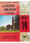
Lough Neagh #14 Ordnance Survey 1:50.000 Northern Ireland
This map of Lough Neagh is part of the Ordnance Survey of Northern Ireland's Discoverer series…
$16.00$12.00
-
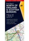
North of England & Scottish Borders AA
This map combines clear design and an easy-to-read scale with more road detail to ensure that you…
$25.00
-
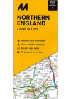
Northern England AA
This map combines clear design and an easy-to-read scale with more road detail to ensure that you…
$25.00
-
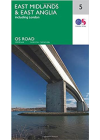
East Midlands & East Anglia - Ordnance Survey 5
The OS map of East Midlands & East Anglia includes all motorways, primary routes and A…
$20.00
-
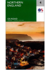
Northern England Ordnance Survey
The Ordnance Survey Road map series are single sided folded maps with the 8 maps providing GB wiht a…
$25.00
-
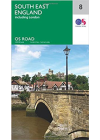
South East England - Ordnance Survey 8
The OS map of South East England includes all motorways, primary routes and A roads across…
$20.00
-
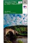
Wales/Cymru & West Midlands - Ordnance Survey 6
The OS map of Wales/Cymru & West Midlands includes all motorways, primary routes and A…
$20.00